The MCHP GIS MANUAL - Exporting Maps


Introduction   Contents


 USING ArcGIS: 
   
1. Basic Use of ArcMap 
   Creating a Map 
   Data Frame Tools
   Data Frame Properties
   Tables and Charts
   Layout View
   Saving Map Documents
   Activity 1

2. Map Projections
   Projections
   UTM
   Datums
  
3. ArcCatalog 
   Basic Uses    
   
4. ArcToolBox 
   Basic Uses    
   
5. Adding Spatial Information
   Georeferencing
   Adding Non-Spatial Data
   Dbase Files
   Activity 2

6. Selecting Data
   By Graphics
   By Location
   Activity 3

7.  Exporting Maps
   Exporting
   Activity 4
  
 
FURTHER INFORMATION:
   General Information
   Data Sets

EXPORTING MAPS

Exporting Maps

Often we want to use maps in PowerPoint presentations, papers or reports. If you do export the image make sure you save the map file so you can recreate the original image at sometime in the future. There are two basic options for transferring maps from ArcMap: 1. They can be copied using ‘Copy Map to Clipboard’ from the edit menu, 2. A copy of the map can be exported into a new format.

1. When copying the map it will be copied as an ESRI Map object with all of the detail and scalability seen in ArcGIS. The image can be pasted directly or, optionally, pasted as an enhanced meta file in the final document.
2. Export Map from the Edit Menu.

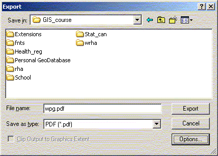
a. If you are just sending maps to other people it is usually best to send the maps as PDF files. One of the nice benefits of PDF files beyond being transportable they are also searchable for text strings and generally not editable by the end user – what you created is what they will get. ArcGIS will directly export maps to PDF files without having to go through a secondary PDF writer.

b. If you want to use a map in a PowerPoint presentation or other Windows package likely you will want to export the file as an enhanced meta file (EMF). Because EMF images are vector based they can be scaled in the importing program without loss of image resolution. EMF images can usually be ungrouped in a CAD or drawing package (even PowerPoint) so different parts can be resized, coloured or modified independent of the other parts of the map.

When exporting maps in EMF format any labels and point symbols should be created using a common font or they will not appear correctly, or at all, when opened on another computers. If there is no common font that has the necessary symbols then you can convert Marker Symbols to polygons when exporting in ArcGIS 9.x. In the export dialog box there are options available at the bottom of the screen one of the options under 'Format' is to convert the symbols to polygons.

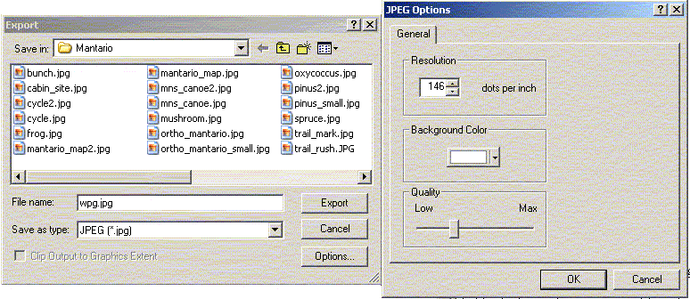
c. JPEG images are a raster format that is often used for presenting information on the WWW, used on a variety of platforms/programs, or can be modified in a graphics package such as PhotoShop. JPEG images are preferred for colour images that will be used on the WWW or some page layout programs.

Activity 4. Exporting a Map to Power Point

Export the WRHA map layout created earlier with the 12 and 23 regions. Make sure that a legend has been created for the 12 community areas. Add a scale bar and north arrow to the map. Export both a JPEG and EMF image. Read both of these into a different power point slide. Try resizing each image to see what happens to the quality of the image as it gets larger. Ungroup the EMF to see the different ‘parts’ that the map represents.

Introduction
Selecting Data: By Location
NEXT
General Information


Contact: Charles Burchill       Telephone: (204) 789-3429

Manitoba Centre for Health Policy
Department of Community Health Sciences, University of Manitoba
4th floor Brodie Centre
408 - 727 McDermot Avenue
Winnipeg, Manitoba R3E 3P5       Fax: (204) 789-3910
Last modified on Friday, 25-Aug-2006 08:06:00 CDT