Distance
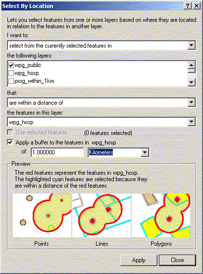
ArcGIS can be used to find points of a given layer that occur within
a specified distance from another layer using ‘Select by Location’
under the Selection menu. To find all public schools within 20 kilometres
of a hospital complete the ‘Select by Location options as
below.
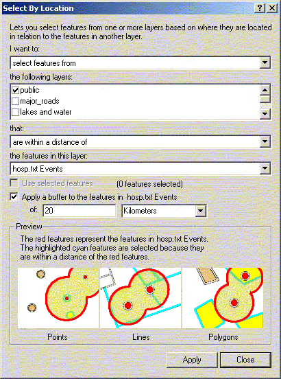
Your map should now highlight all schools within 20 kilometres
of a hospital.
A similar effect can be achieved by creating buffers around hospital
points. Under the tools menu, choose ‘Buffer Wizard’.
Choose to buffer the features of the layer hosp.txt and click Next.
At the next screen, choose to create multiple rings (three, with
a distance of 10 km between each ring). Then click Next.
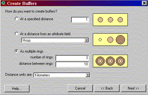
At the next screen, you can choose whether or not you want the
barriers of the buffers to dissolve when they overlap. Once you
have chosen that, save the buffer as a new theme. When you click
on Finish, a new theme will be created called Buffer of Hosp.txt.
Pull the theme down so that it’s not covering the points.
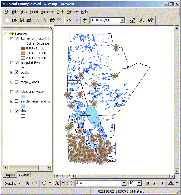
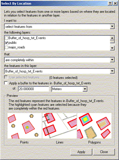
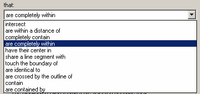
To select all public schools within 30 kilometres of a hospital,
first clear the previous selection. Go to Select by Location under
the Selection menu. This time, choose to select features of the
active theme that are completely within the selected features of
your Buffer layer. When you click on New Set, all public schools
that fall within your buffers will be highlighted.
Obviously, buffers are not necessary for determining distance from
points, but they offer another option for doing it. Using another
layer (a buffer in this case) for selecting data gives you many
more options such as those listed below. This is especially important
when selecting polygons or lines based on the features of another
theme.
Activity 3. Selecting Data within
WRHA
A. Determine the programs that are within 1 km
of hospitals.
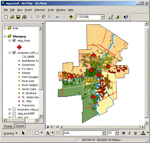
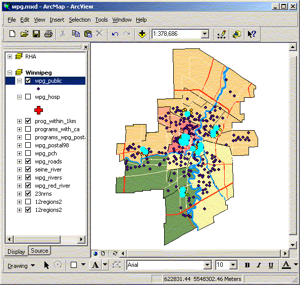
Add the program data (programs.dbf) table to the WRHA project.
Using the postal code on the program file and the 1998 Winnipeg
postal code locations (wpg_postal98), georeference each of the programs
to a specific location using a join on postal code. You should realize
that a number of programs do not have an associated postal code.
Join the Winnipeg CA areas to the program data so each program
is identified with an individual community area. Change the symbol
colours or shape to confirm that each program falls inside the appropriate
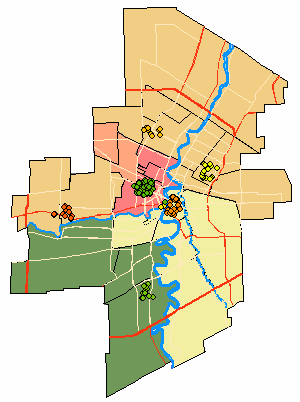
community area. Identify all of the programs that fall within 1km
of hospitals using the select by theme option. Save the selected
programs into a new shape file.
B. Calculate distance from schools with Kindergarten
classes to nearest hospital
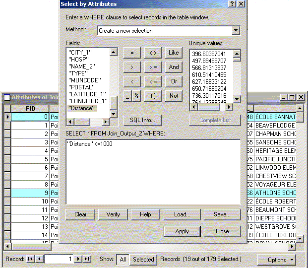
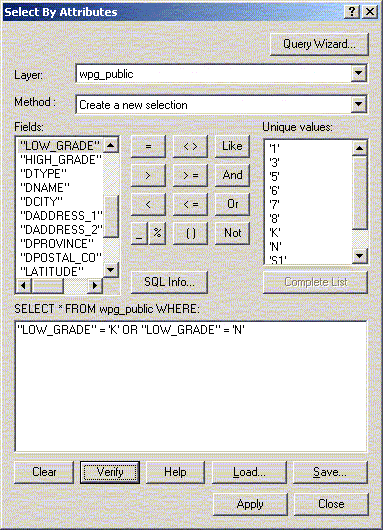
Add the Winnipeg schools (wpg_public) to the WRHA view. Query (Select
by Attributes) the schools attribute table to identify those with
kindergarten classes (low_grade=’K’ or low_grade=’N’).
Division 1 has some schools that start at nursery school (N) all
of these schools also have kindergarten classes. You may also limit
the data using the Definition property. Save this file as a projected
shape file or the distance calculated in the join will be in the
shape file units (decimal degrees – this is different than
the spatial query above for some reason). Using the Join option
for the new Kindergarten public schools do a spatial join with the
hospital data. This will add a distance measurement for each school
to the nearest hospital. In the attribute table query all kindergarten
schools within 1 km of a hospital. Convert this to a shape file.
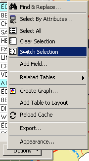
Try to reverse the selection so you get all the schools more than
1 km from a hospital (hint: in the attribute table use the switch
selection options menu item then select all of the kindergarten
schools from that set).
You can do a similar selection using select by location options.
An example is given below.
 Introduction
Selecting Data: By Graphics |
NEXT
 Exporting Maps
 |
|