BASIC USE: DATA FRAME TOOLS
|
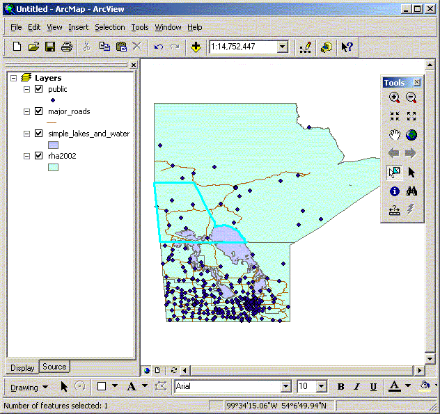
Data Frame Tools If you want to get a better look at the southern part of the province,
where there is the largest concentration of public schools. You
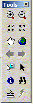
can zoom to any part of your view by clicking on the “zoom
in” button: When you take your cursor over your view, you should have a little
magnifying glass instead of an arrow. You can zoom in two ways:
clicking the mouse while the magnifying glass is in the view will
zoom into the map (and re-center the map to where the magnifying
glass was positioned). If you want to zoom in more quickly, click
and drag the magnifying glass to create a box around the area you
want to zoom into. If you want to look at Winnipeg only, make a
small box around the Winnipeg area, and see how your map looks.
The “zoom out” button If you want to re-centre your map but leave the scale the same,
use the “pan” button The button below the “pan” button is the “select
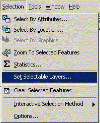
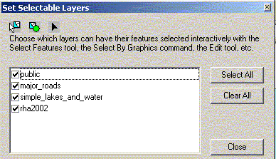
feature” button You can select or work with multiple layers at one time. Notice that, in the above view, the layer for rha.shp to the left of the map is highlighted. To limit the layers that are selectable use the Selection menu items ‘Set Selectable Layers’. To select more than one feature at once, hold down the shift key and click on each feature that you want or drag a box around the features you want to select. The “select feature” button works similarly to the zoom buttons, in that you can either click on the map (whichever portion of the feature you click on will be selected), or click and drag a box around what you want selected (any portion that falls partly within the box will be selected). You can clear the selected portions of a theme by selecting ‘Clear Selected Features’ from the ‘Selection’ menu. In the tool bar there are a number of other zooming buttons. Zoom
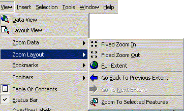
in, Zoom out, and “Zoom to full extent”. The last item
looks like a small globe and will take you to a view of your entire
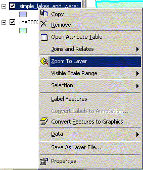
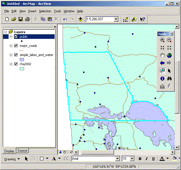
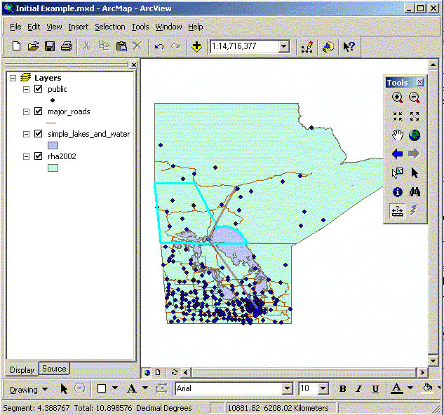
map If you want to zoom to the active layer then right click on the layer of interest in the table of contents and select ‘Zoom to Layer’. This will take you to a view of just that theme. If you highlight Simple_lakes_and_waters.shp and click on “Zoom to Layer”, you get a close-up of the main lakes of Manitoba. If you want to zoom to a selected feature then you can select ‘Zoom to Selected Features’ from the Selection menu or from the view menu. This item will zoom in on whatever portion(s) of the map are currently selected for the active theme. If you select Nor-Man, as in the earlier example, and click “Zoom to selected”, you would get something like the following picture. Notice the scale on the upper right side. It tells you the scale of the current view. You can change the zoom of your map by entering the scale by hand. Currently, the scale is approximately 1:5.2 million. If you zoom to full extent, the scale is approximately 1:14 million. Large scale will give you lots of detail in a small portion of your map – you can zoom to a specific street in Winnipeg if you want. Small scale will show you a large area with little detail (such as all of Canada). . Within ArcMap all features in a theme have associated information.
This information can be displayed by clicking on the information
button ( It is also possible to measure distances in ArcView, using the
“measure” button When you click on the button, the cursor changes to a ruler. If you want to measure the distance between Winnipeg and Thompson, click on Winnipeg in your View. Then move your ruler to Thompson. You will notice that a line appears between Winnipeg and wherever you move your icon. The distance between your two points will be displayed in the bottom left-hand corner of your screen. If you want to know the approximate road distance between Winnipeg and Thompson, you can change the direction of your “ruler” by clicking at the point you want to change direction, and then continuing with a new line. The display tells you the total distance as well as the distance of your current line. The distance is measured in the distance units set in the frame properties window. Note that the distance measure is displayed in base measurement
unit for the frame by default. To change it to kilometers, go to
Data Frame Properties under the View menu, and change distance units
to kilometers.
|