BASIC USE: DATA FRAME PROPERTIES
|
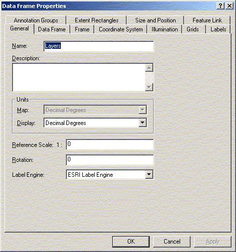
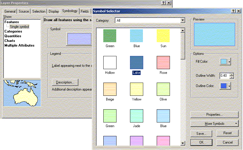
Data Frame Properties Data Frame properties will allow you to change a number of other settings for the frame. To start, you can change the name of the frame. Similar to the layers you can have multiple frames in a single project. These frames can display different areas of the same province, the whole country or even the world. You can change the background color or even the projection (what ever that is…). Add Grids (measurement) and Graticules (Lat/Long) to indicate measurement locations and distances. Changing the Look of your Map Your lakes are probably some colour other than blue right now. To change them to blue, click on the lakes symbol (or fill) in the Table of Contents. A dialog box that allows you to change the fill and pattern should open. Alternatively double-click the lakes title in the Table of Contents. This will open the layer properties where many more things can be changed including the symbology. Click on the fill color to select the fill and border. Lakes are often represented as a light blue with a darker blue outline.
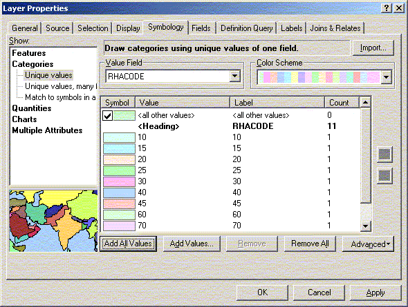
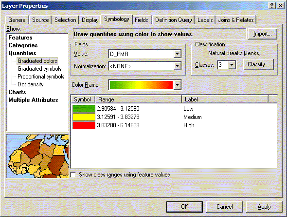
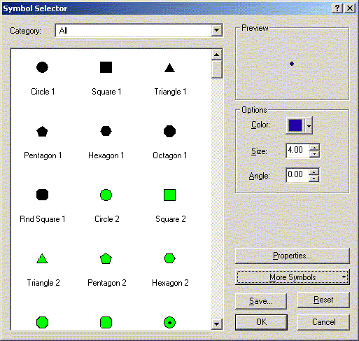
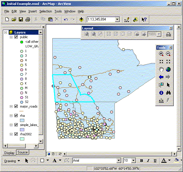
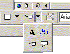
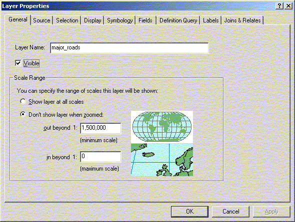
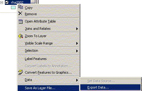
You can also have different values of a layer take on different colours. For example, within the RHA.shp layer, you could have each RHA take on a different colour. Open the layer properties by double clicking on the layer name or selecting Layer Properties from the context sensitive menu. In the layer properties under symbology select categories in the dialog box with the unique values option. Click on the “add all values” button to enter the RHA values. Another option is to display numeric values as quantiles with a continuous gradient in the colour. You could group your RHAs by premature mortality rate by choosing “Quantiles”, and then choosing D_pmr as your classification field. Again, you are given a choice of colour schemes, each colour representing a PMR category. Polygons are, obviously, not the only layers that can be edited. Double-click on your roads legend, and you can change the size of your lines. Points can also be edited, not only by colour, but also by size, shape and symbol. You can use the options for multicoloured layers for points as well. If you wanted to group your schools by the lowest grade taught at the school, you would choose Unique Value under legend type, and then choose Low_Grade under values field. Notice how long the legend for public schools has become – you can’t even see the legends for your other layers any more. To fix this, click on the minus (-) beside the layer in the Table of Contents. You should now only have a label for the schools, and you should be able to see the legends for your other layers again. If you want to export your map and have labels for your features directly in your view, you can create them using the label menu item from the context sensitive menu or by setting up the labels in the layer property. You can also add the labels individually by clicking on the “Label” button under the ‘A’ in the Draw toolbar. Options for label styles and placement position are found in the layer properties. The layer properties, as you have seen already, allow you to change the properties of each layer. You should give your layer an appropriate name since you can use the same shape file a number of times in a single frame. This name will also be used for legend titles and attribute tables (which will be mentioned below). This name does not change the original shape (shp) file or name on your computer. You can give the layer a definition and add comments to it under Definition. A definition (e.g. ( [SLI] = “1” )) will be applied to your whole layer. Selections, conversions, and other processing will only be applied to the features defined in this definition. The General tab also allows you to specify the minimum and maximum scale at which the themes will show up. This is useful for road networks, postal code points, or in our example, public school points, when viewed at too small a scale; they clog up a lot of Southern Manitoba. Try changing the maximum scale (out beyond) for public.shp to 1.5 million then zoom in and out around this scale. You can take selected portions of your theme and save them as new shape files. If you wanted to create a map of Northern Manitoba, you could select Nor-Man and Burntwood, and then under “Data”, choose “Export Data” from under the context sensitive menu for the RHA layer. You can then save the selected polygons with a new name, such as north.shp, for future use in new maps. If you did not want to export your shape file you could limit your
layer using the definition property To unselect the selected features on your map, select the “Clear Selected Features” from the “Selection” menu. It will remove the selections from all portions of the map.
|