| Georeferencing - Adding spatial information
to your data
ArcGIS will allow you to convert address information to spatial
information using indexed geocoding services. These typically are
shape files that contain road networks and address information.
This page provides some basic information on georeferencing both
spatial and non-spatial points and areas.
A. Referencing existing spatial data.
This example will show you how to add information from one spatial
source to another based on the spatial location of points. If two
layers exist you can add attribute information from one layer to
the other based on a spatial join.
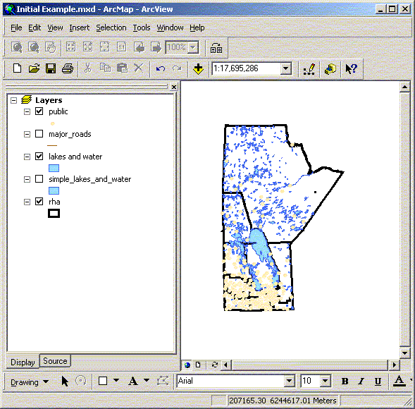
- In this example we will add RHA information to the location
of public schools.
i. Load the public schools shape file and the RHA boundaries file
(d:\gis_course\rha\public.shp, d:\gis_course\rha\rha.shp).
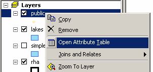
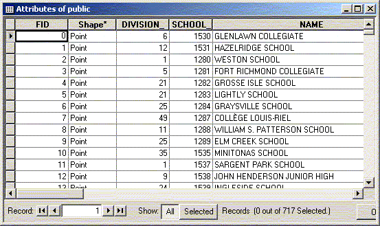
ii. Preview the attribute table of the schools and the RHAs.
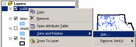
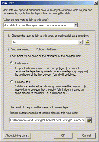
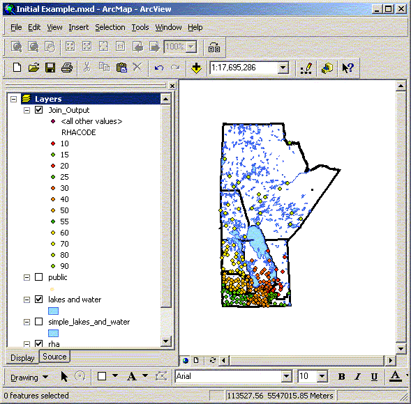
iii. Add information from the RHA polygons to the public school
points using a spatial join. Once you join the data together a
new layer containing the join is added to your map.
When working with point data more information
along with the joined attributes such as distance from the points
or summary information. Be sure you select an appropriate place
to put the joined shape file. When joining polygons to polygons
the joined information is either for completely contained polygons
or summary stats for intersecting polygons – for our work
neither of these is usually acceptable. Convert the polygons
to centroids then join the polygon information to the new centroid
points. Centroids can be calculated using an extension such
as X-tools.
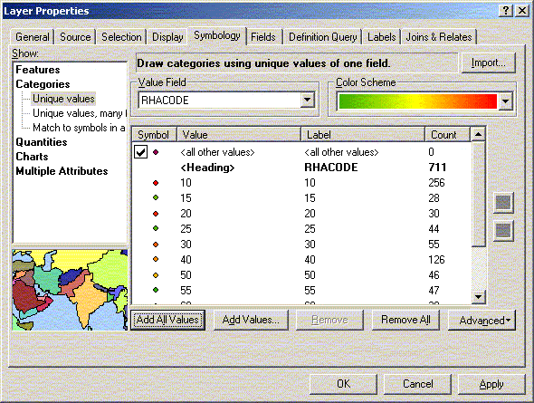
iv. Open the properties for the new joined layer and change the
symbology to show the RHA codes for each school.
B. Referencing non-spatial data
- Using simple joins between tables
In this case we will georeference Nursing Stations in Manitoba
using the associated community postal code. In this example we
will add the source files for nursing stations and postal code
locations from Statistics Canada. This is one of the most common
forms of georeferencing that we use at MCHP. There are some issues
with using the PCCF file that need to be considered. In general
we use only the current records (see birth/retire dates) with
the single link indicator with a value of ‘1’. In
all cases a manual review should be done of all of the points
since there are some location problems with a few of the postal
codes from rural towns and municipalities (e.g. in recent PCCF
files Beausejour postal codes are located in the RM of St. Clements
near the Brokenhead reserve).
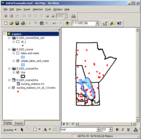
a. Add the Nursing Stations.txt file and preview the attribute
table (d:\gis_course\rha\nursing_stations.txt).
b. Add the SLI_1 table based on the Statistics Canada PCCF file.
This file provides the most likely location based on population
of each postal code in Manitoba in 1998 (d:\gis_course\stat_can\sli_1.dbf).
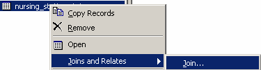
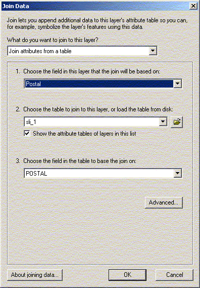
c. Join the PCCF data to the Nursing stations data based on postal
code. Use the join option under the Nursing stations pop-up menu.
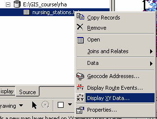
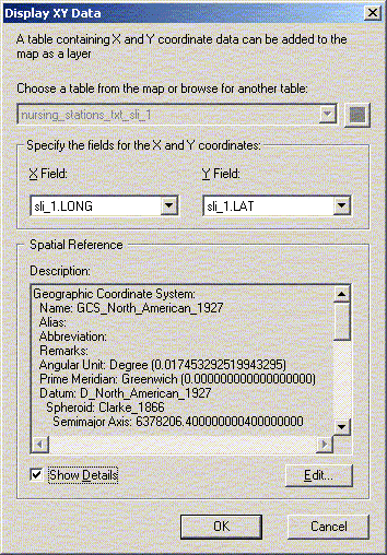
d. Add the Nursing Station locations to the data using the
‘Display X/Y data’ option under the pop-up menu
or from the tools menu.
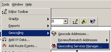
2. Geocoding location based on addresses
If you have a full street address you can geocode points using
a street network file. The first thing that you will need to do
is locate a street network file. Then index the file for geocoding
in ArcCatalog. Once the Geocoding Service is set up the index
can be added to a map for use.
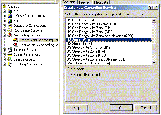
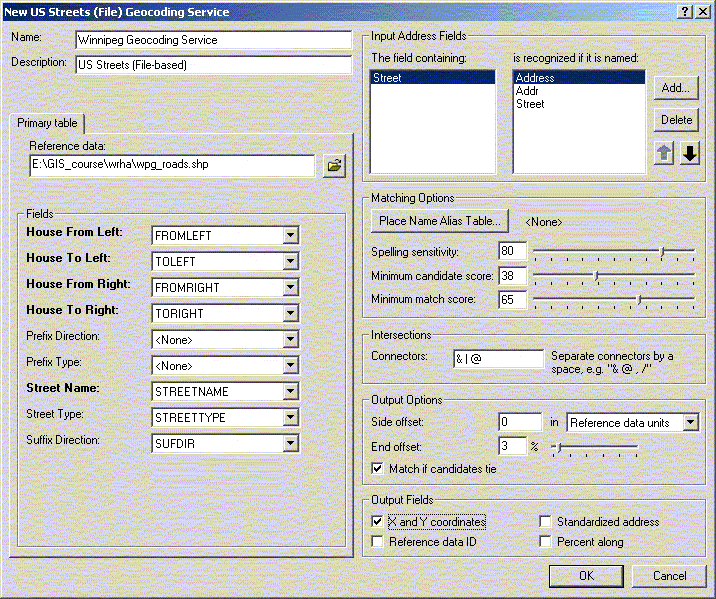
a. In ArcCatalog define a new Geocoding Service based on the
Winnipeg Roads file using the ‘US Streets’ definition
(d:\gis_course\wrha\wpg_roads.shp). This will generate an index
file of the appropriate format that can be used in geocoding.
b. In this example you will need to create a map of Winnipeg,
including the Winnipeg and neighbourhood boundaries, and the
Winnipeg Roads file (d:\gis_course\wrha\wpg_bound.shp, d:\gis_course\wrha\12regions.shp,
d:\gis_course\wrha\wpg_roads.shp).
c. Add the Winnipeg Libraries data file to the map as well (d:\gis_course\wrha\library.dbf).
Preview the attributes table and note that there is a street
address as well as a postal code.
d. Define the geocoding service within the map that you want
to use.
e. Select the file that you want to geocode and identify the
appropriate options of interest. This will include the address
field and the sensitivity (Geocoding Options).
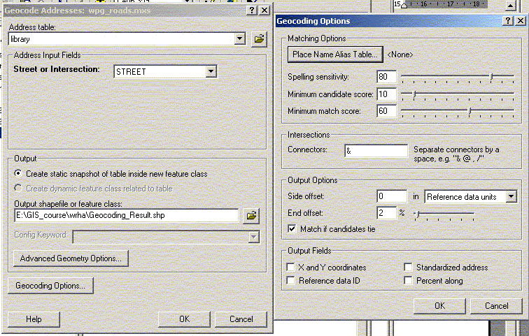
f. After the setting the starting options run the first pass
(OK). You will get the results of the geocoding process and
be given the opportunity to interactively match any remaining
items.
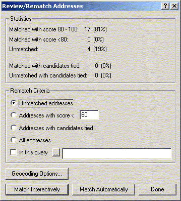
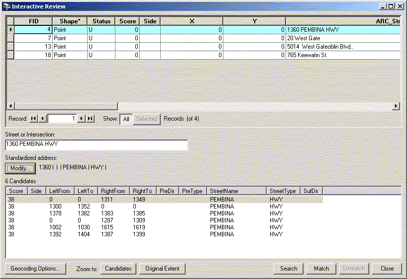
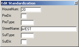
In this example West Gate was not found. ArcGIS assumed that
West was a prefix indicating the direction (e.g. East/West/North/South)
and not part of the actual name. In the actual file Gate is the
street type and West is the name. By selecting ‘Modify’
you can adjust the name standard and find the correct location
in the map. This is often an iterative process between the file
name, electronic file, and physical maps. In some cases the actual
address can not be found but a ‘close’ address can
be used instead. Put the address at the close point then edit
the shape file manually later if necessary.
After geocoding addresses you can always go back to the last
session and continue the session. This allows you to stop and
check addresses, locations, etc… then complete the task
at a later time.
g. If possible you should try to verify the geocoding results
using an alternative source of information (e.g. local knowledge/ground
truthing, postal codes, etc…). Run a final test using
the postal code location (PCCF) information for each library.
Do both sources give you the same location, why not, which is
correct?
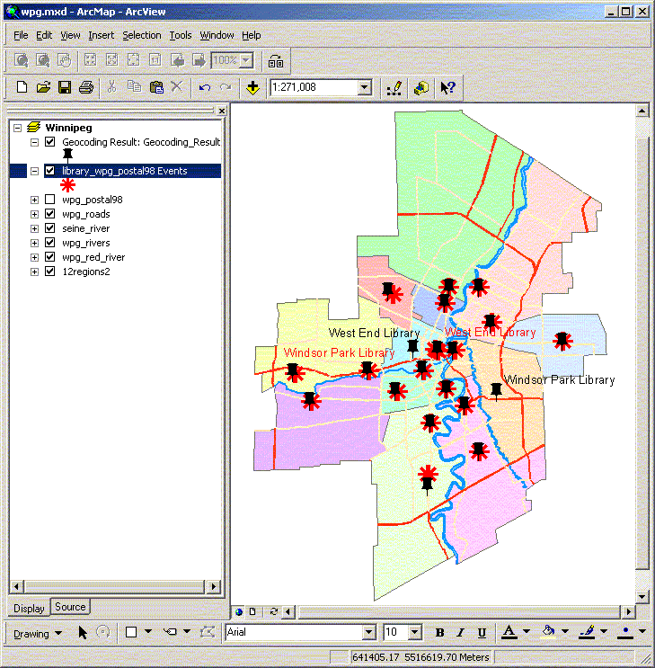
- The Windsor Park Library is correctly located using the street
address but incorrectly using the postal code location.
- The West End library is correctly located using the street address
but incorrectly using the postal code location.
- The Pembina Trails and Sir William Stephenson libraries are
in slightly different locations.
 Introduction
ArcToolbox: Basic Uses |
NEXT
 Adding Spatial Information: Adding Non-Spatial Data
 |
|