The MCHP GIS MANUAL - PCCF Example


Introduction   Contents


 USING ArcGIS: 
   
1. Basic Use of ArcMap 
   Creating a Map 
   Data Frame Tools
   Data Frame Properties
   Tables and Charts
   Layout View
   Saving Map Documents
   Activity 1

2. Map Projections
   Projections
   UTM
   Datums
  
3. ArcCatalog 
   Basic Uses    
   
4. ArcToolBox 
   Basic Uses    
   
5. Adding Spatial Information
   Georeferencing
   Adding Non-Spatial Data
   Dbase Files
   Activity 2

6. Selecting Data
   By Graphics
   By Location
   Activity 3

7.  Exporting Maps
   Exporting
   Activity 4
  
 
FURTHER INFORMATION:
   General Information
   Data Sets

PCCF EXAMPLE

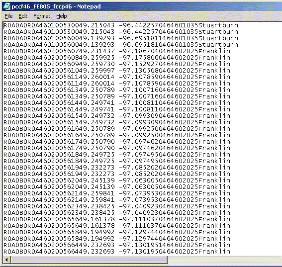
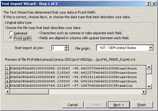
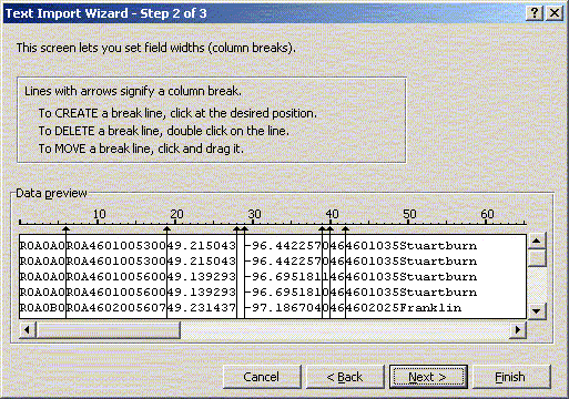
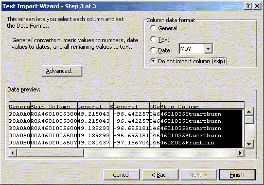
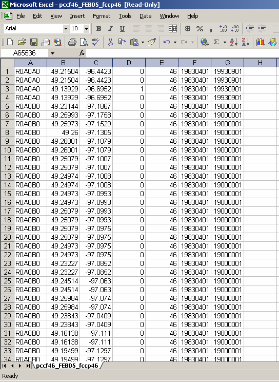
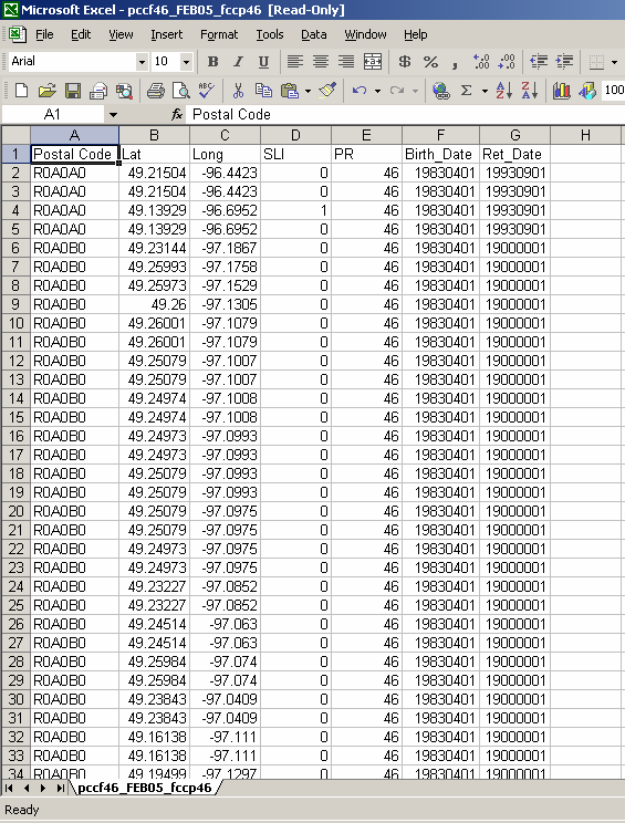
PCCF Example:

The files obtained from Statistics Canada will not be in a format recognizable to ArcGIS. The data will come as a fixed record length file and will need to be converted to a readable database. The easiest way to format the file will be to convert it into a DBF IV file using Excel.

Your data will look something like this:

After downloading the file, open it in Excel. Excel will not immediately open the file, it will guide you through the text to columns wizard to convert the data into a readable format. You will want to choose the fixed width option within the text wizard.

To find the record layout for the data (i.e. the width) look through the reference guide that is associated with the downloaded data. As directed, create break lines to separate the data. You will only need the following data; Postal Code, Lat, Long, SLI, PR, Birth_Date, Ret_Date.

All other data you do not need, you can choose not to import it by selecting the non desired columns and checking off ‘do not import column (skip)’. Once all the desired data is ready to import click finish and your data will be separated.

Before saving the file, you will need to add titles. Insert a row above the data and name the columns accordingly. Your data is now ready to be saved. Go to ‘Save As’ under the file menu and save the file as a DBF IV file. Make sure when you are saving the file that the cell that is currently selected has data in it, otherwise the saved file will be blank.

NOTE:

  • The latitude and longitude are in decimal degrees.
  • There are some postal codes in the data that have multiple instances based on their birth and retirement dates. Active postal codes have a retirement date of 19000001.
  • The PR (province) is important when downloading the entire PCCF file, however Statistics Canada releases PCCF’s based on each province so it is not really important in this case.
  • The SLI (Single Link Indicator) can be used to establish a one-to-one relationship between postal codes and dissemination areas, blocks, or block-faces. A SLI value of 1 indicates the best or only record for the postal code. A SLI value of 0 indicates an additional record for a postal code.
Data Sets


Contact: Charles Burchill       Telephone: (204) 789-3429

Manitoba Centre for Health Policy
Department of Community Health Sciences, University of Manitoba
4th floor Brodie Centre
408 - 727 McDermot Avenue
Winnipeg, Manitoba R3E 3P5       Fax: (204) 789-3910
Last modified on Friday, 25-Aug-2006 08:06:00 CDT